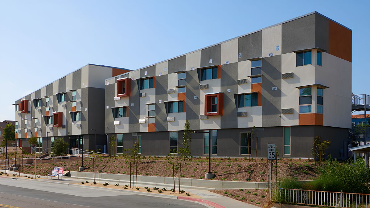
Look into how a neighbourhood changes over time takes more than looking at new buildings or comparing current property listings. In San Ysidro, California, housing and development research can reveal how residential areas expanded, roads changed, public facilities were introduced, and planning decisions influenced the community. By reviewing public planning documents, historical maps, property records, and archived reports, you can build a clearer picture of how the neighbourhood evolved.
This research can be useful for residents, students, property owners, local historians, and anyone interested in urban development. You might want to understand when a housing area was built, investigate a proposed development, trace changes in land use, or learn why certain streets look different today. The most reliable approach is to combine several sources, verify important dates, and distinguish between proposed projects and changes that were actually completed.
Planning
Start by defining the question you want to answer. A focused research question makes it easier to identify relevant records and avoid spending hours reviewing documents unrelated to your goal.
For example, you could investigate when a residential subdivision first appeared, how a commercial area developed, whether a road widening project affected nearby properties, or how zoning regulations changed over time.
San Ysidro is part of the City of San Diego, so many planning and development records are maintained through city departments. Depending on the subject, relevant information may also be held by San Diego County, regional agencies, or state and federal authorities.
Before searching, write down the approximate location, street names, property address, and period you want to study. If you are researching a specific parcel, record its current address and, if available, its Assessor’s Parcel Number (APN). Property addresses can change, so an APN may help you connect records that use different street names or numbering systems.
It is also useful to create a timeline. Begin with the earliest evidence you can find, then record major milestones such as subdivision approvals, building permits, road improvements, zoning changes, and construction completion dates.
Documents
Planning documents explain what public agencies considered, approved, or required when development was proposed. They are often among the most useful sources for understanding why a neighbourhood changed.
Look for planning applications, staff reports, environmental reviews, zoning decisions, subdivision maps, development agreements, and City Council or planning commission meeting records. These documents may describe a project’s intended use, building size, access routes, public infrastructure needs, and potential environmental impacts.
The City of San Diego website is a practical starting point for current planning information and development-related services. Its planning resources can help you identify the relevant department and understand how to search for project information.
When reviewing a planning file, pay attention to the dates and status of each document. An application may be submitted years before construction begins. A project may also be revised, delayed, rejected, or approved with conditions.
A useful record might include the original proposal, public comments, staff recommendations, approval conditions, and later permit documents. Together, these records can show how the final development differed from the initial plan.
Maps
Historical maps help you visualise changes that written records may describe only briefly. By comparing maps from different periods, you can identify new streets, altered road layouts, changing land uses, and the expansion of residential or commercial areas.
Useful map types include:
- Historical street maps showing how roads and neighbourhood boundaries changed.
- Topographic maps showing terrain, waterways, and physical features.
- Subdivision maps identifying parcel boundaries and planned streets.
- Zoning maps indicating the types of land uses permitted at particular times.
- Aerial photographs showing buildings, vacant land, and infrastructure from above.
The US Geological Survey provides historical topographic map resources through its map collections. The Library of Congress also holds maps and other historical materials that may provide regional context.
For San Ysidro-specific research, city planning maps and historical aerial imagery may be especially useful. Compare maps using stable reference points such as major intersections, rail lines, waterways, or long-established roads. These features can help you recognise the same location even when street names or parcel layouts have changed.
Remember that maps are not always produced for the same purpose. A zoning map shows what uses are permitted, not necessarily what was built. A subdivision map may show proposed parcels without proving that every planned home was constructed.
Property
Property records can help establish how individual parcels were divided, transferred, or developed. They are especially useful when you are researching a particular house, apartment building, or group of properties.
Start with the county assessor’s property information to identify parcel details and relevant assessment records. The San Diego County Assessor/Recorder/County Clerk provides access to several types of property and recorded-document information.
Depending on the property and record availability, you may find parcel information, assessed values, recorded deeds, subdivision documents, or other filings. These records can help connect a property to a particular owner, transaction, or legal description.
However, different records answer different questions. An assessor’s record is primarily concerned with property assessment and identification. A deed documents a transfer of an interest in property, while a building permit may show when construction or major renovation was authorised.
Do not assume that the date a property first appears in an assessment database is necessarily the year it was built. Similarly, a sale date does not tell you when the building was constructed. Cross-check property details against permits, historical maps, and other records before drawing conclusions.
Permits
Building permits and related inspection records can provide evidence of physical changes to individual properties. Depending on the age of the building and the city’s record-retention practices, files may document new construction, additions, conversions, major renovations, or demolition.
The City of San Diego’s development and permitting services are a sensible place to begin. Search by property address or parcel number where possible, and ask the relevant department about older files that may not be available through an online search.
When examining permit records, distinguish between the date a permit was issued, the date work began, and the date the project passed final inspection. These dates can differ significantly.
Permit records also have limitations. Older documents may be incomplete, stored in physical archives, or difficult to connect with modern property numbering. Minor work may not have required the same approvals as major construction, depending on the regulations in force at the time.
If you are researching a whole neighbourhood, permits can help identify periods of increased construction activity. If you are studying one property, they can reveal a more detailed sequence of changes to the building.
History
Historical records add context to planning files and maps. Newspaper articles, city directories, census records, photographs, and oral histories can help explain why development occurred and how it affected residents.
Historical newspapers may report proposed housing projects, road improvements, public meetings, disputes about land use, or the opening of local services. City directories can help trace addresses and businesses, while photographs may show what a street or property looked like before redevelopment.
Census data can provide information about population and housing characteristics, although geographic boundaries and reporting methods may change between census years. When comparing data over time, make sure you are comparing similar areas and definitions.
Local historical collections, including those held by the San Diego History Center and public libraries, may contain photographs, maps, personal papers, and other resources. Community members may also have family photographs or memories that help identify when a building appeared or how a street was used.
Oral histories can be particularly valuable, but they should be treated as one form of evidence rather than definitive proof of a date. Memories may be approximate, so compare them with contemporary records whenever possible.
Comparison
A strong housing history emerges when several sources support the same finding. Instead of relying on a single document, compare planning approvals, permits, maps, property records, and contemporary reporting.
The following table shows how different sources can work together:
| Research question | Primary source | Supporting evidence |
|---|---|---|
| When was a subdivision planned? | Subdivision map or planning file | Historical maps and meeting records |
| When was a home constructed? | Building permit or inspection record | Aerial images and property records |
| How did land use change? | Historical zoning maps | Planning reports and aerial imagery |
| When did a road change? | Public works or project records | Historical maps and newspaper articles |
| Who owned a property? | Recorded deed | Assessor records and historical directories |
| Why was a project changed? | Staff report or public meeting minutes | Public comments and news coverage |
Create a spreadsheet with columns for the date, source, property or location, reported change, document status, and notes. Include a citation or archive link for every important claim.
This approach helps distinguish between facts established by records and interpretations based on several pieces of evidence. It also makes it easier to revisit a conclusion if a new document appears.
Requests
Not every historical record is available online. Some documents may be stored in physical files or managed by a different department than expected.
If an online search does not produce the information you need, contact the relevant city department or county office. Provide a specific address or APN, the approximate date range, and the type of record you are seeking. A focused request is usually easier to process than a broad request for every document associated with a neighbourhood.
You may also be able to submit a public records request under California’s public records laws. Explain the subject and date range as clearly as possible, and ask whether the records are available digitally or require an in-person visit. Access can depend on retention policies, privacy protections, exemptions, and the condition of older files.
Keep track of request dates, staff responses, fees, and any documents you receive. If a record cannot be located, ask whether it may be held by another agency or archive.
Accuracy
Researching development history requires care because different documents can contain conflicting dates or descriptions. A project may be proposed in one year, approved in another, and completed several years later. A street may appear on a planning map long before it is fully constructed.
Always identify what each date represents. Distinguish between an application date, an approval date, a permit date, and a construction or completion date. Similarly, separate zoning permission from actual land use.
It is also important to consider what the records do not show. A building permit may describe a physical alteration but say little about its effect on residents. A planning report may describe anticipated benefits without documenting the project’s long-term outcomes.
For a balanced account, combine official documents with historical reporting, photographs, and community perspectives. This gives you a stronger basis for explaining not only what changed, but also how and why the change happened.
Researching housing and development changes in San Ysidro becomes more manageable when you approach the process step by step. Start with a clear question, identify the property or area, locate planning documents, compare historical maps, and use permits and property records to verify key dates. Add newspapers and community histories to understand the wider context. By keeping careful notes and checking claims across multiple sources, you can build a credible timeline of how San Ysidro’s homes, streets, and public spaces have evolved.
FAQs
Where can I find San Ysidro planning records?
Start with the City of San Diego’s planning and development resources.
Can historical maps show housing changes?
Yes, maps and aerial images can reveal new streets, buildings, and land-use changes.
How can I find when a home was built?
Check building permits, inspection records, property files, and historical maps.
Are property sale dates the same as construction dates?
No, a sale records a transaction, not when the building was constructed.
What if historical records are not online?
Contact the responsible agency or submit a focused public records request.