Knowing flood risk maps, drainage patterns and environmental conditions can help San Ysidro residents make better-informed decisions about property, home improvements, neighbourhood planning and emergency preparedness. Whether someone is researching a home purchase, investigating recurring street flooding or learning about future development, reliable environmental information provides an important starting point.
San Ysidro is part of the City of San Diego, and local conditions can vary considerably from one location to another. Rainfall, surface slopes, storm drains, paved areas, nearby waterways and the condition of drainage infrastructure can all influence how water moves through a neighbourhood. A property that appears dry during most of the year may still experience runoff or localised flooding during intense rainfall.
No single map can explain every environmental risk. Flood hazard maps, topographic information, drainage records, rainfall data and environmental reports each answer different questions. By combining these resources and understanding their limitations, residents can build a clearer picture of local conditions without relying on assumptions or outdated information.
Research
Start by defining the question you want to answer. Are you checking whether a property lies within a mapped flood hazard area, trying to understand why water collects on a street, evaluating a proposed development or researching environmental conditions before buying land?
Each objective requires different information.
For property research, begin with the exact street address or parcel location. For a drainage concern, identify the affected street, nearby slopes, low points and possible water flow routes. For a development proposal, look for project documents that discuss drainage design, stormwater management and environmental review.
Record the date of your research and keep copies of the maps and reports you consult. Online datasets can change as new surveys, flood studies or infrastructure improvements become available.
It is also helpful to separate confirmed information from observations and assumptions. A resident may report that a driveway floods after heavy rain, for example, but that observation alone does not establish the cause. The issue could involve surface runoff, a blocked drain, inadequate grading or another local condition.
Treat personal observations as useful evidence to investigate rather than as a substitute for technical assessment.
Flooding
Flood risk is influenced by more than proximity to a river or other visible waterway. Heavy rainfall can overwhelm drainage systems, collect in low-lying areas or flow across paved surfaces before reaching a suitable outlet.
Flooding can occur through several mechanisms:
- Riverine flooding: Water rises beyond the normal boundaries of a river or channel.
- Surface-water flooding: Rainfall accumulates or flows across the ground when infiltration or drainage capacity is insufficient.
- Drainage-related flooding: Stormwater infrastructure becomes blocked, overloaded or unable to convey water effectively.
- Coastal flooding: Coastal water levels and storm conditions affect exposed areas.
- Debris-related flow: Water carries sediment, vegetation or other material that can obstruct drainage or increase damage.
These categories are not mutually exclusive. A single storm may produce several types of flooding in different locations.
In an urban area such as San Ysidro, the amount of paved land can be particularly relevant. Roads, parking lots, rooftops and other hard surfaces reduce the amount of rainfall that can soak directly into the ground. As a result, more water may travel over the surface and enter storm drains or low-lying areas.
The practical question is not simply whether a neighbourhood has flooded before. It is also how water moves through the area, whether drainage infrastructure can handle intense rainfall and whether local conditions have changed since earlier studies were completed.
Maps
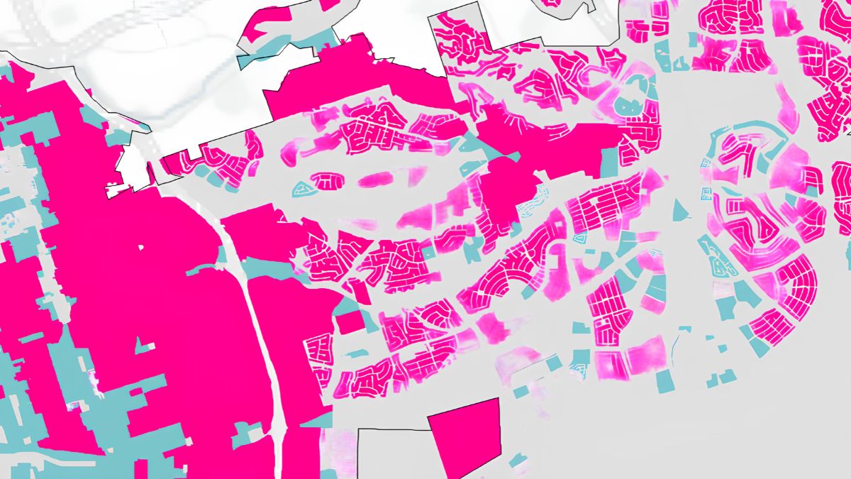
Flood hazard maps help identify areas where flooding may occur under specified conditions. They are valuable research tools, but their meaning depends on the data, methods and assumptions used to produce them.
One important source is the Federal Emergency Management Agency’s Flood Map Service Center. FEMA provides official flood hazard mapping information for the United States, including maps used in many floodplain management and insurance contexts.
Residents researching San Ysidro can search the FEMA map service using a property address and review the mapped flood zone. Depending on the location, the map may identify areas with different levels or types of assessed flood hazard.
Some FEMA maps distinguish areas associated with a 1% annual chance of flooding, commonly called the 100-year floodplain. This terminology can be misleading: it does not mean a flood occurs only once every 100 years. It refers to a 1% chance in any given year under the relevant modelling assumptions.
A mapped zone should not be interpreted as a complete prediction of whether a specific building will flood. Map boundaries have limitations, and local drainage problems may occur outside mapped high-risk areas. Conversely, being inside a mapped hazard area does not mean flooding will necessarily occur at a particular property during every major storm.
Use the official map as one part of the investigation, then check whether newer local studies, drainage reports or property-specific information are available.
Terrain
Topography describes the shape and elevation of the land. It helps explain where rainfall may flow, where water could accumulate and how slopes influence runoff.
A topographic map may show contour lines, elevation values, ridges, valleys and depressions. Contour lines connect locations of equal elevation. When lines are close together, the terrain is generally steeper; when they are farther apart, the slope is generally gentler.
For drainage research, identify the highest and lowest points around the property or street you are investigating. Water typically moves downhill, although kerbs, walls, road crowns, drainage channels and other features can redirect its path.
A low point can collect water if nearby slopes channel runoff towards it. A steep paved surface may move water quickly, while a flatter area may allow water to accumulate if there is no effective outlet.
Digital elevation models can provide useful regional context, but they may not capture every kerb, driveway, wall or storm drain. Small differences in ground level can matter greatly for an individual property.
For this reason, online terrain data should not be used alone to determine whether a building, driveway or proposed construction site is safe from flooding. Property-specific elevation surveys or engineering assessments may be necessary when the decision carries significant financial or safety implications.
Drainage
Drainage patterns describe how water travels across the land and through natural or constructed channels. They may include street gutters, storm drains, culverts, ditches, channels and underground pipes.
Knowingthese patterns can help residents investigate recurring water accumulation and identify questions to ask local authorities or qualified professionals.
Begin by examining the surrounding terrain. Look for streets that slope towards an intersection, drainage channels that cross the area and low points where several runoff paths may converge. Where available, compare these observations with official stormwater infrastructure maps and drainage studies.
Do not assume that a visible storm drain can handle every rainfall event. Drainage systems are designed around particular conditions, and capacity can be affected by debris, sediment, maintenance issues or rainfall that exceeds the design assumptions.
Residents should also distinguish stormwater drainage from the sanitary sewer system. These systems serve different purposes, and the presence of one does not mean that the other can manage surface flooding.
If water repeatedly collects in a public street, blocks access or appears to enter buildings, document the location and report the issue through the appropriate City of San Diego service channel. Photographs taken from a safe location, the date, approximate duration and observed flow direction may help officials investigate.
Never enter a flooded roadway, drainage channel or stormwater structure to inspect it. Water depth, current strength and hidden hazards can be difficult to judge from the surface.
Rainfall
Rainfall information helps place flood maps and drainage observations into context. Total rainfall matters, but so does its intensity and duration.
A moderate amount of rain falling over several hours may produce a different response from the same amount falling within a short period. Ground saturation, soil type, vegetation, pavement and the condition of drainage infrastructure also influence how quickly water runs off.
Historical rainfall records can help residents understand the conditions experienced in previous storms. Weather observations and official forecasts can help with short-term awareness, while longer-term climate information may be useful for planning discussions.
However, historical averages do not guarantee future conditions. A property that has remained dry during several rainy seasons may still experience flooding during an unusually intense storm or after a change to nearby land surfaces.
When reviewing rainfall information, note the location of the measurement station, the observation period and the units used. Rainfall measured several miles away may not perfectly represent conditions over a particular street or drainage basin.
For immediate storm warnings and emergency information, use official weather and emergency management sources rather than relying only on historical charts or community posts.
Environment
Environmental conditions can influence how water moves through an area and what happens when flooding occurs. Soil characteristics, vegetation, land cover, erosion, contamination and nearby sensitive habitats may all be relevant.
Soil affects infiltration, which is the process by which water enters the ground. Some soils allow water to soak in relatively quickly, while others absorb it more slowly. Even permeable ground may become saturated during prolonged rainfall, reducing its ability to absorb additional water.
Vegetation can slow surface runoff, intercept rainfall and help stabilise soil. Removing vegetation or replacing open ground with paving may change how water moves across a site. The effect depends on the scale of the change, local terrain and the drainage measures used.
Erosion is another consideration. Fast-moving runoff can carry soil and sediment into drains, channels and nearby waterways. Sediment may reduce drainage performance or affect downstream water quality.
Environmental research should also consider whether a location is near a waterway, wetland, protected habitat or other area subject to special rules. Not every site has these features, and their presence should be confirmed through official records rather than inferred from a map alone.
If a property has a history of industrial or commercial use, environmental records may also be relevant. Potential soil or groundwater contamination is a separate issue from flood risk, but flooding and runoff can sometimes affect how contaminants move. A qualified environmental professional can help interpret site-specific findings where necessary.
Development
New development can change the way water moves across a neighbourhood. Additional roofs, driveways and parking areas may increase the amount of impervious surface, while grading can alter slopes and redirect runoff.
That does not mean every new project necessarily increases flood risk. Properly designed drainage, detention facilities, permeable surfaces and other stormwater controls can help manage runoff. The important question is whether the project’s design complies with applicable requirements and addresses the conditions of the specific site.
Residents researching a proposed development can look for planning applications, environmental documents and stormwater management information. Depending on the project, documents may discuss existing drainage patterns, anticipated runoff, proposed drainage facilities, erosion control or measures to protect water quality.
When reviewing a report, pay attention to the study area and assumptions. A drainage analysis for one parcel may not fully explain conditions across an entire neighbourhood or downstream catchment.
Useful questions include:
- How will the project change the amount of paved or roofed surface?
- Where will runoff be directed?
- Are existing storm drains or channels part of the analysis?
- What measures will manage runoff during and after construction?
- Could construction sediment reach nearby drains or waterways?
- Who is responsible for maintaining proposed drainage facilities?
These questions do not establish that a project is unsafe. They help residents understand whether the relevant issues have been examined and where additional clarification may be needed.
Verification
Different sources can provide different views of the same location. A FEMA flood map, a topographic map, a city drainage record and a developer’s engineering report may use different scales, dates and assumptions.
Before drawing conclusions, check the source and date of each document. Determine whether the information covers the exact property or only a broader area. Look for notes describing the map’s intended use, limitations and underlying methods.
A useful comparison is shown below.
| Source | Main purpose | Important limitation |
|---|---|---|
| FEMA flood maps | Identify mapped flood hazard areas | May not show every local drainage problem |
| Topographic maps | Show terrain and elevation patterns | May omit small drainage features |
| Rainfall records | Describe observed precipitation | A nearby station may not reflect local conditions exactly |
| City drainage records | Provide information about public infrastructure | Records may not include every private drainage feature |
| Environmental reports | Assess specified environmental conditions | Findings apply to the scope and date of the study |
| Engineering surveys | Examine site-specific conditions | Quality and usefulness depend on the survey’s scope |
If two sources appear to disagree, do not automatically assume that one is wrong. They may be describing different hazards or using different data. Ask the responsible agency or a qualified engineer to explain the difference before relying on the information for a major decision.
Preparation
Flood research is most useful when it informs practical decisions. Residents do not need to become drainage experts to take sensible precautions, but they should know when to seek professional advice.
For a property purchase, review the available flood hazard information, ask about any known flooding history and consider whether a professional inspection or elevation assessment is warranted. Standard home inspections may not include a detailed hydrologic or drainage analysis, so clarify the scope of any assessment.
For an existing home, keep gutters and approved drainage pathways maintained, avoid directing runoff onto neighbouring properties and follow local rules for changes to grading or drainage. If water enters a building, use qualified professionals to assess the cause and identify suitable repairs.
During heavy rainfall, follow official alerts and avoid flooded roads, underpasses and drainage channels. Do not walk or drive through moving floodwater. If evacuation instructions are issued, follow them promptly.
Residents can also keep a simple record of recurring drainage problems. Dates, rainfall conditions, photographs taken safely and the locations of standing water may help identify patterns over time. Report urgent hazards through official channels rather than waiting to compile a complete record.
Knowing flood risk in San Ysidro requires more than checking a single map. Flood hazard information, terrain, rainfall, drainage infrastructure and environmental conditions each contribute a different piece of the picture.
By using current official sources, recognising the limits of online maps and seeking professional advice when decisions require technical certainty, residents can investigate local conditions more responsibly and make better-informed choices about property, development and emergency preparedness.
Official Resources
- FEMA Flood Map Service Center – Search official flood hazard maps by property location.
- City of San Diego – Find city services, stormwater information and reporting options.
- National Weather Service San Diego – Check local forecasts, rainfall information and weather alerts.
- USGS National Map – Look into topographic and elevation-related data.
- California Department of Water Resources – Access California water planning and related resources.
FAQs
Where can I check flood risk maps for San Ysidro?
Start with FEMA’s official Flood Map Service Center.
Does being outside a flood zone mean no risk?
No. Local drainage and surface-water flooding may still occur.
How do topographic maps help?
They show elevation patterns that can influence water flow.
Who should inspect recurring drainage problems?
Report public issues to the city and seek qualified advice if needed.
Can new development change runoff patterns?
Yes. Grading and added paved surfaces can affect runoff.