Public land records can tell a detailed story about a property, from previous owners and recorded sales to boundary descriptions, easements and certain land-use restrictions. For residents, prospective buyers, researchers and local history enthusiasts in San Ysidro, California, these documents can help explain how individual properties have changed over time and how the surrounding community has developed.
However, no single record provides a complete picture. Ownership documents, property tax assessments, planning files and historical maps each reveal different information. Knowing where to look and how to interpret the documents can help people make better-informed decisions without confusing recorded facts with assumptions.
Ownership
Property ownership history is often documented through deeds and other recorded instruments. A deed generally identifies the parties involved in a transfer and describes the property, although the details depend on the document and the transaction.
In San Ysidro, people researching a property’s ownership history can begin with the San Diego County Assessor/Recorder/County Clerk. The office maintains property assessment information and official recorded documents, subject to its search procedures and record availability.
Recorded deeds may help establish when ownership changed, who transferred an interest and what type of transfer occurred. For example, a property might have changed hands through a sale, inheritance, gift or transfer into a trust.
It is important to distinguish a recorded deed from a complete legal title review. Some ownership interests, claims or legal issues may not be apparent from a basic document search. Anyone considering a significant purchase or property dispute may need a title professional or real estate attorney to review the relevant records.
Deeds
A deed is one of the most useful starting points when tracing a property’s recorded history. By locating successive transfers, a researcher may be able to build a timeline showing how ownership changed.
Several types of documents can appear in a property’s recorded history:
- Grant deeds: Commonly used to transfer real property interests in California.
- Quitclaim deeds: Transfer whatever interest the grantor may have, without the same assurances typically associated with a grant deed.
- Trust-related documents: May reflect transfers involving a trust or changes in how property is held.
- Reconveyances and releases: May document the release of certain recorded security interests.
- Easements: May establish rights to use part of a property for a specific purpose.
A document’s presence does not automatically establish the property’s current legal status. For example, a deed of trust and a later reconveyance need to be read together to understand the recorded history of a particular security interest.
When researching older transactions, record names, dates, document numbers and legal descriptions carefully. A name alone may not identify the correct property, particularly when people share similar names or ownership has passed through an estate or trust.
Boundaries
Property boundaries are another important part of land research. Recorded deeds may contain legal descriptions that identify a parcel through lot and block numbers, subdivision references, metes-and-bounds descriptions or other survey information.
These descriptions can help researchers connect older documents with present-day parcels. However, a street address is not always sufficient to establish a legal boundary, and online maps may display approximate parcel lines rather than surveyed property limits.
For San Ysidro properties, county assessor parcel information can help identify a parcel and its assessment details. If the exact boundary matters for a fence, construction project, sale or dispute, consult a licensed land surveyor or other qualified professional.
A title document, assessor map and survey serve different purposes. Reading them together can provide more context than relying on any one source.
Taxes
Property tax records can offer another view of a property’s history. Assessment information may include a parcel number, assessed value, taxable value and other details available under county procedures.
The San Diego County Assessor’s records can help researchers understand how a property has been assessed. Tax information may also help distinguish one parcel from another when several properties have similar addresses.
However, assessed value is not necessarily the same as current market value. California’s property tax system generally operates under Proposition 13, with rules governing assessed-value increases and reassessment in specified circumstances. A property’s assessed value therefore may differ substantially from the price it could command in the current market.
Tax records also should not be treated as conclusive proof of ownership. Assessment and title records serve different administrative and legal functions.
Landuse
Public records can reveal how a property is designated or regulated for development. Zoning rules, planning documents, permits and environmental reviews may indicate whether land is intended for residential, commercial, industrial or other uses.
San Ysidro is part of the City of San Diego, so municipal planning resources are important for understanding local land-use requirements. Researchers can start with the City of San Diego’s Development Services Department and its planning information.
Depending on the property and the records available, research may uncover:
- Zoning designations and permitted uses.
- Building permits and certain development approvals.
- Subdivision maps and parcel changes.
- Public easements or access requirements.
- Historic preservation information or applicable designations.
- Planning documents associated with proposed developments.
A zoning designation does not guarantee that every possible use is permitted. Specific activities may require permits, additional approvals or compliance with other regulations. Researchers should verify current rules directly with the responsible planning agency before making decisions based on a property’s apparent development potential.
History
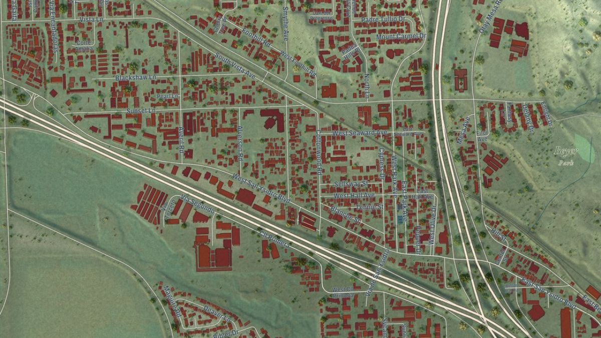
Land records can also help explain how San Ysidro has changed over time. Older subdivision maps, historic deeds and archived planning documents may reveal when land was divided into smaller parcels, when streets were laid out or when agricultural or undeveloped land transitioned toward residential and commercial use.
Researchers can compare historical maps with current parcel maps to identify changes in lot configurations and neighbourhood layouts. Old street names, subdivision names and legal descriptions may differ from present-day terminology, so matching records can require patience.
Local libraries, historical collections and public planning archives may provide additional context that is not obvious from a deed. Newspaper archives, historic photographs and community histories can help explain the people and events associated with a property.
Still, historical documents should be interpreted carefully. A parcel’s past use does not necessarily establish its current zoning, ownership or legal development rights. Likewise, a gap in available records does not prove that a property had no prior owner or activity.
Easements
Easements can affect how a property is accessed or used. They may provide rights for utilities, drainage, access or other purposes across part of a parcel.
A recorded easement can be important when evaluating a property’s practical use. For instance, an easement may limit where a structure can be placed or allow another party to access a designated area.
Researchers should look for the document establishing the easement and determine whether later documents modify or release it. The wording, location and legal effect can vary considerably.
Not every restriction appears in a simple online property summary. Title reports, recorded documents and professional legal review may be necessary to establish the restrictions that apply to a specific property.
Research
A structured search can save time and reduce the risk of confusing one property with another.
- Identify the parcel. Start with the property’s address and, if available, its assessor parcel number.
- Search recorded documents. Use the county Recorder’s official resources to locate deeds and other relevant instruments.
- Review tax information. Check assessment records for parcel identification and available valuation history.
- Investigate land use. Consult city zoning maps, planning documents and permit resources.
- Compare dates. Build a timeline using document dates, recording dates and historical maps.
- Verify important findings. Contact the relevant agency or a qualified professional when legal ownership, boundaries or development rights are at stake.
Some records may be available online, while older documents or certain detailed files may require an in-person request, formal search or payment of applicable fees. Access restrictions can also apply to some information.
For an ownership or boundary question with financial or legal consequences, consider obtaining a professional title search rather than relying solely on a do-it-yourself review.
Limitations
Public records are valuable, but they have limits. Documents may be difficult to locate, contain outdated descriptions or require specialist knowledge to interpret. A recorded transaction also does not necessarily resolve every question about a property’s current legal status.
Privacy is another consideration. Although many property records are public, residents should use the information responsibly and avoid publishing personal details unnecessarily.
The most reliable approach is to compare several relevant sources, distinguish official records from third-party summaries and confirm important details with the agency responsible for maintaining them.
Knowing property records can help San Ysidro residents explore neighbourhood history, evaluate real estate and investigate land-use questions with greater confidence. County deed and assessment records can establish a useful starting point, while city planning files help explain how a property may be used today.
By combining these sources and recognizing their limitations, researchers can build a clearer picture of how a parcel has changed over time without treating any single document as the final word.
FAQs
Where can I find San Ysidro property records?
Start with the San Diego County Assessor/Recorder/County Clerk.
Can deeds show previous owners?
Yes, recorded deeds can help trace ownership transfers over time.
Do tax assessments show market value?
No, assessed value may differ from current market value.
Where can I check zoning rules?
Consult the City of San Diego’s Development Services Department.
Can online maps prove property boundaries?
Not necessarily; a licensed surveyor may be needed to confirm boundaries.