A neighborhood’s built environment tells a story long before anyone opens a history book. Streets reveal how people move, commercial areas show where daily life and economic activity meet, and public spaces reflect how residents gather, relax, and connect with one another. In San Ysidro, a community at the southern edge of San Diego near the U.S.-Mexico border, these features offer a useful way to understand how geography, cross-border movement, local businesses, and planning decisions shape everyday life.
San Ysidro is more than a place people pass through on their way across the border. It is a residential neighborhood with its own businesses, institutions, public spaces, and community priorities. Its built environment reflects both its international location and the practical needs of people who live, work, shop, and travel there.
Look into this environment means looking beyond individual buildings. How wide are the sidewalks? Where do people gather? How do commercial streets connect with residential blocks? And how might new development change the relationship between transportation, local business, and community life? These questions help explain how San Ysidro has evolved and what its physical landscape can reveal about its future.
Geography
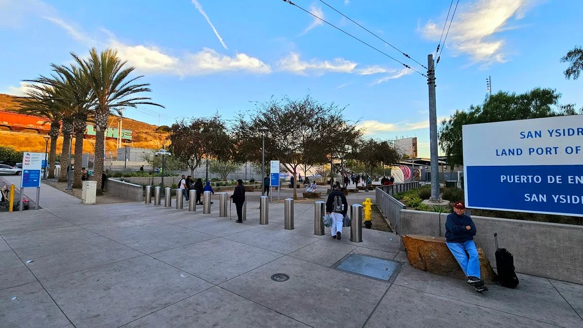
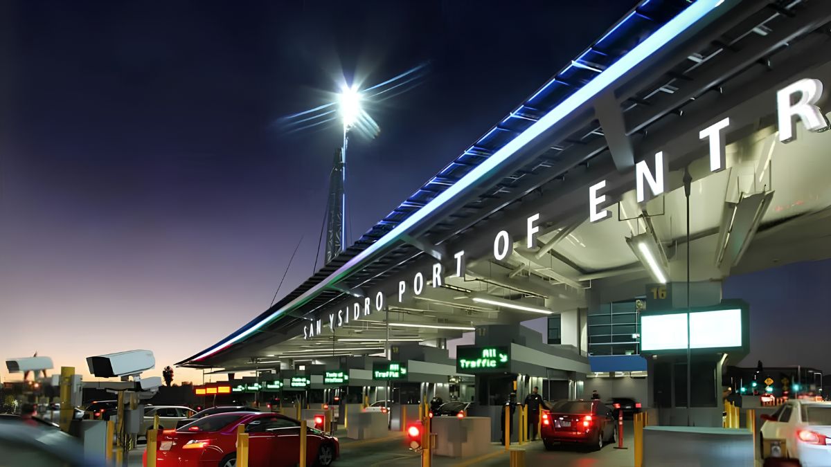
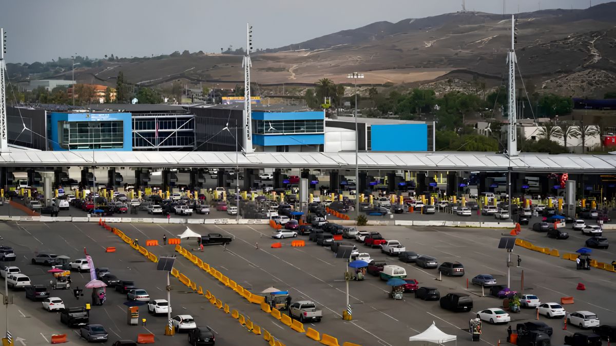
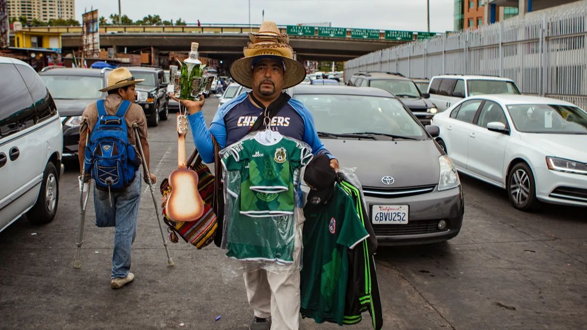
San Ysidro’s location is central to understanding its development. Situated next to the international boundary and the San Ysidro Port of Entry, the neighborhood is influenced by cross-border travel, regional transportation, and commercial activity. The border is not simply a line on a map. It affects movement patterns, business opportunities, infrastructure needs, and the daily routines of many residents.
The surrounding street network connects residential areas with shopping destinations, transit services, public facilities, and border-related travel routes. These connections can bring economic activity to nearby commercial areas, while also creating challenges involving congestion, pedestrian safety, parking, and access to local destinations.
San Ysidro’s built environment also reflects its place within the wider San Diego region. Residents need routes to schools, workplaces, healthcare, parks, and other services. Streets and transit connections therefore serve more than one purpose: they support local trips while also linking the neighborhood to regional destinations.
This combination of local and international influences gives San Ysidro a distinct urban character. Its development cannot be understood through architecture alone; geography and movement are equally important.
Streets
Streets are among the clearest indicators of how a community functions. They determine whether residents can walk to nearby shops, how safely children can travel to school, and how easily people with mobility limitations can reach public services.
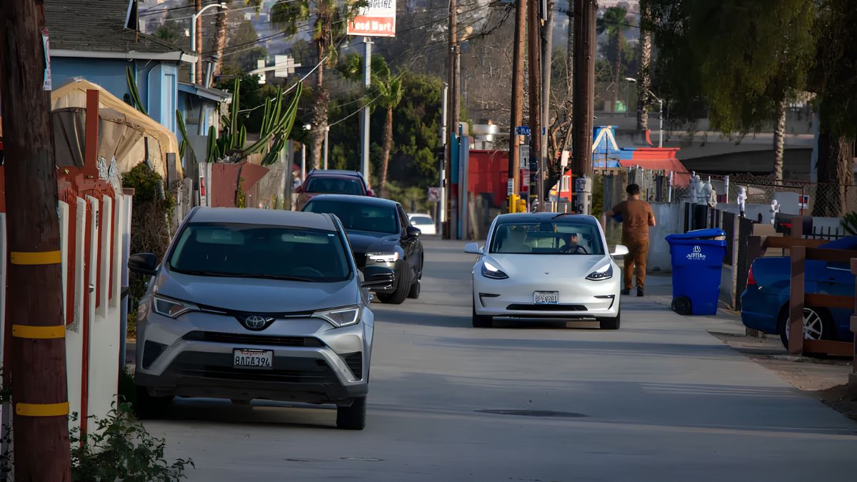
In San Ysidro, the relationship between major roads and smaller neighborhood streets helps shape the experience of moving around. Larger roads can support substantial traffic volumes and connect destinations across the region. Residential streets, by contrast, often serve a more local role, providing access to homes and neighborhood facilities.
The design of a street influences how people use it. Continuous sidewalks, safe crossings, visible signs, appropriate lighting, and accessible curb ramps can make walking more practical. Where these features are missing or inconsistent, even a short trip may become difficult for older adults, people with disabilities, families with young children, and residents carrying shopping bags.
Street design also influences how comfortable an area feels. Trees, shade, landscaping, and places to pause can make walking more pleasant, particularly during warm weather. A street that moves vehicles efficiently but offers little comfort to pedestrians may function differently from one designed to support walking, transit access, and neighborhood activity.
These details matter because streets are not merely channels for traffic. They are part of the public realm, connecting homes and businesses while shaping how people experience their surroundings.
Commerce
Commercial areas provide another way to understand change in San Ysidro. Shops, restaurants, service businesses, and small storefronts support local employment and give residents places to meet everyday needs. Their locations, building styles, and connections to sidewalks reveal how business activity interacts with the surrounding neighborhood.
The area around San Ysidro Boulevard and other local commercial corridors illustrates the importance of neighborhood-serving businesses. A commercial street can function as more than a row of shops: it can be a place where residents run errands, enjoy a meal, access services, and encounter neighbors during ordinary daily routines.
Cross-border connections add another dimension. Visitors traveling from elsewhere in the region or across the border may contribute to customer demand for certain goods and services. At the same time, local businesses need to serve residents who depend on convenient, affordable options close to home. The balance between these groups can influence storefront uses, operating hours, pedestrian activity, and the kinds of businesses that succeed.
The physical form of a commercial area affects how welcoming and accessible it feels. Shops with entrances facing the sidewalk may encourage walking and make the street feel active. Buildings set behind large parking areas can offer convenient vehicle access but may create longer walking distances between destinations. Neither arrangement tells the whole story on its own; the experience depends on street crossings, shade, parking access, building entrances, and the surrounding land uses.
Commercial areas can also change as business conditions and community needs evolve. A vacant storefront may become a new restaurant, a service business, or another use permitted by local rules. Renovations can improve building appearance and accessibility, while new development may introduce different building heights or more intensive land uses.
These changes can create opportunities, but they also raise questions. Will existing small businesses be able to remain? Will new spaces be affordable to local entrepreneurs? Will redevelopment improve pedestrian access? Looking at these issues together offers a more complete understanding of how commercial development affects community life.
Housing
Housing is a major part of the built environment because it determines not only where people live, but also how homes connect to streets, transit, services, and public spaces. San Ysidro’s residential areas include different building types and patterns, each with its own relationship to the surrounding neighborhood.
Detached homes, apartments, and other residential forms can create different demands for parking, open space, transit, and nearby services. The presence of multiple housing types can also influence how a neighborhood accommodates households of different sizes, ages, and financial circumstances.
As communities consider additional housing, the discussion often extends beyond the number of units proposed. Residents may want to understand building height, setbacks, privacy, sunlight, parking, traffic, and the relationship between a project and neighboring homes. These are practical questions about how new construction fits into an established setting.
Housing development can also affect the use of nearby commercial areas. More residents may increase demand for grocery stores, cafes, healthcare, and other services. If those destinations are accessible on foot or by transit, new housing can help support a more connected neighborhood. If everyday destinations are difficult to reach without a car, the benefits may be less evenly distributed.
The broader challenge is to consider housing alongside infrastructure and public amenities. Buildings do not exist in isolation. Their long-term contribution depends partly on whether residents can access safe streets, public transportation, schools, parks, and essential services.
Transit
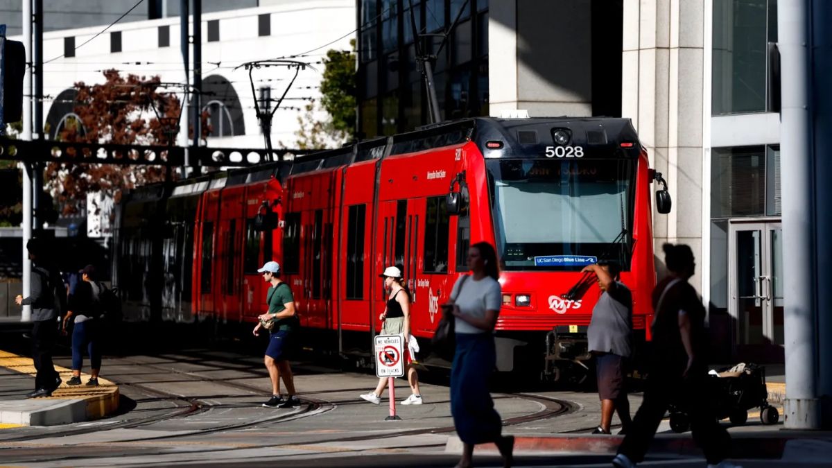
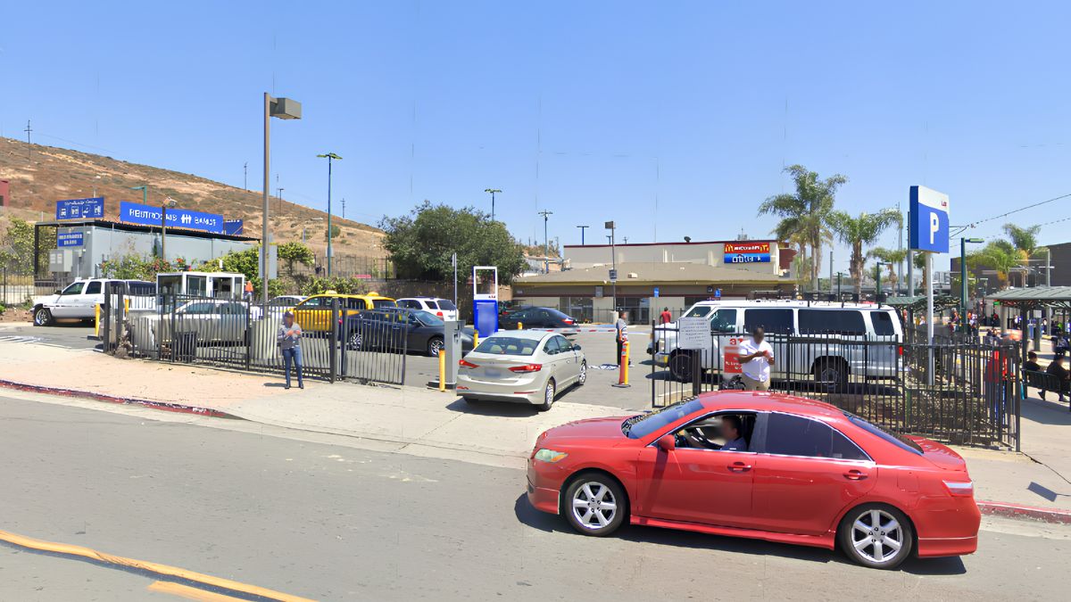
Transportation infrastructure strongly influences the way San Ysidro is built and experienced. The San Ysidro Transit Center connects regional transit services near the international border, making transportation an important part of the neighborhood’s physical structure.
The area’s relationship with cross-border travel means that pedestrians, buses, private vehicles, and other modes of transportation can compete for space and attention. Good connections between transit facilities, sidewalks, commercial destinations, and residential streets are therefore essential.
Transit-oriented planning generally aims to make it easier for people to reach useful destinations without relying entirely on private cars. This can involve safer pedestrian routes, clearer wayfinding, accessible crossings, convenient transit stops, and a mix of destinations within reasonable travel distances.
For older adults and people with disabilities, the details are especially important. A transit station may be nearby in geographic terms, but a route with missing sidewalks, difficult crossings, or limited shade can make the journey challenging. Accessibility must be considered across the full trip, not just at the station entrance.
The same principle applies to people carrying groceries, parents traveling with children, and commuters making transfers. Convenient connections can save time and support local businesses by making commercial destinations easier to reach.
For current route and service information, residents can consult the San Diego Metropolitan Transit System. To understand how transportation and land use fit into broader planning decisions, the city’s community planning materials provide useful context.
Public
Public spaces give a neighborhood room to breathe. Parks, plazas, recreation facilities, libraries, and other shared places support activities that are difficult to accommodate inside homes or commercial buildings. They provide opportunities for exercise, relaxation, community events, and informal social interaction.
In San Ysidro, public spaces can be understood as part of a larger network of destinations. A park is more useful when residents can reach it safely. A recreation facility becomes more accessible when transit connections, sidewalks, entrances, and signs are easy to navigate. The quality of a public space depends both on what is inside it and on how it connects with its surroundings.
Design matters, too. Shade, seating, lighting, accessible paths, landscaping, and clean facilities can influence who feels comfortable using a space and how long people stay. Families may value play areas and open lawns, while older adults may prioritize benches, shade, smooth walking surfaces, and accessible restrooms.
Public spaces also provide a place for community identity to develop. Cultural events, neighborhood gatherings, recreational programs, and informal meetings can bring people together across generations. These everyday interactions may be less visible than a major construction project, but they are an important part of a neighborhood’s character.
The availability and quality of shared spaces can become especially significant as residential areas grow or land uses change. When evaluating a new development, it is useful to ask whether the surrounding community has sufficient public amenities and whether existing spaces are maintained and accessible.
Planning
Planning decisions help determine how streets, buildings, public spaces, and transportation fit together. Zoning regulations, community plans, development approvals, and infrastructure projects can influence what gets built and how the neighborhood changes over time.
The City of San Diego’s San Ysidro Community Plan is a useful starting point for understanding the area’s long-term planning framework. Community plans establish policies and goals for land use, mobility, public facilities, and neighborhood development. They can help residents compare a proposed project with the broader vision for the area.
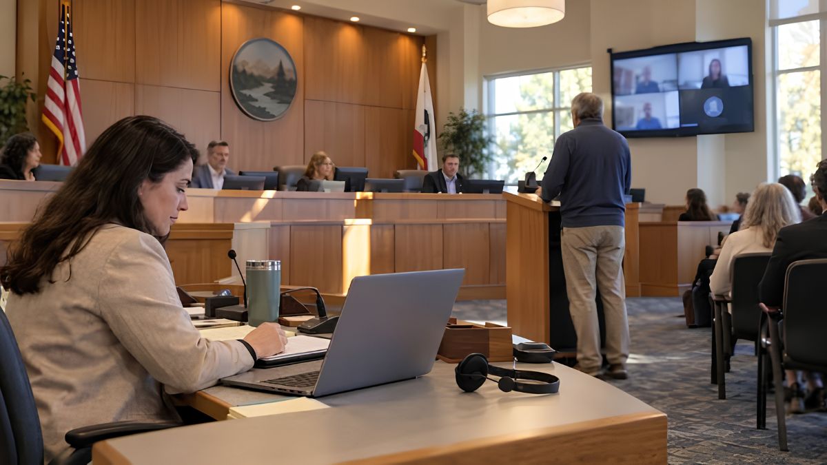
The city’s planning department also provides information about planning processes, development, and relevant policies. For a specific project, residents should review the current application materials, site plans, staff reports, and any applicable environmental documents rather than relying only on a general description of the proposal.
When examining a development project, consider several questions:
- How does the project connect with existing streets and sidewalks?
- Will people be able to reach nearby shops, parks, and transit stops safely?
- Does the design respond to the scale and character of nearby buildings?
- What parking, traffic, drainage, or infrastructure changes may be required?
- Will the project provide accessible routes and usable public spaces?
- What opportunities will residents have to review the proposal and provide comments?
These questions help shift the conversation from whether a building looks attractive to how it functions as part of a larger neighborhood. A well-designed project should be evaluated in the context of surrounding streets, services, housing, and public life.
Change
Changes to the built environment can bring both benefits and trade-offs. New housing may help accommodate demand, renovated storefronts may support business activity, and improved sidewalks may make daily travel safer. At the same time, construction can disrupt access, increase pressure on infrastructure, or raise concerns about the cost of living and the future of established businesses.
The effects are rarely identical for everyone. A new commercial development may be convenient for some residents while creating parking or traffic concerns for others. A street redesign may improve pedestrian safety but require adjustments to vehicle access or curbside parking. Understanding these differences is essential to a balanced discussion.
It is also important to distinguish visible change from measurable outcomes. A newly landscaped street may look more attractive, but its success also depends on maintenance, accessibility, safety, and how people actually use it. A new building may add housing or commercial space, but its wider value depends on how well it connects to the neighborhood and whether supporting infrastructure is adequate.
Residents can contribute by observing how spaces work in everyday life, reporting specific access or safety concerns, and participating in public meetings when relevant proposals are reviewed. Photographs, precise locations, and clear descriptions of an issue can make community feedback more useful to planners and decision-makers.
San Ysidro’s built environment reflects its border location, residential life, commercial activity, and connections to the wider San Diego region. Its streets shape movement, its businesses support daily needs, and its public spaces create opportunities for people to connect. As the neighborhood continues to evolve, looking at these elements together provides a clearer picture of what development means in practice. The strongest approach to change considers not only what is built, but also how the result serves the people who live, work, shop, and travel through the community.
FAQs
What shapes San Ysidro’s built environment?
Its streets, housing, businesses, transit connections, and public spaces.
How do streets affect neighborhood life?
Street design influences safety, walking, accessibility, and local connections.
Why are commercial areas important?
They support local businesses, jobs, shopping, dining, and social interaction.
Where can I find San Ysidro planning documents?
Visit the City of San Diego’s official San Ysidro Community Plan page.
How can residents influence development decisions?
They can review proposals and participate in applicable public meetings.